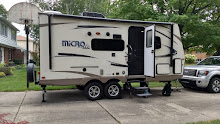
Fri. June 14: Friday we did nature in the morning and
anthropology in the afternoon. The National Park’s Hoh Rainforest area was just
30 miles south and then east of the campsite. After going through their Visitor
Center and getting two more Olympic passport stamps we took their two nature
hikes. One was the 1¼ mile Spruce Trail through a newer forest that is
constantly changing due to the Hoh River that runs along it. The other was the
¾ mile Hall of Mosses. This higher, older, more established forest had many
large Big Leaf Maples whose branches were hung with heavy drapes of moss. Both
had large old growth Sitka Spruce, Western Hemlock, Douglas Fir, and the newcomer—Cedars.
Throughout the forests we were serenaded by many Winter Wrens with their
lovely, trilling song. The sun was out much of the time and the temperature
right around 60° so it didn't seem much like the rainforest that it is. The
area gets 142 inches of rain every year. The ground is covered completely with
ferns and moss and other small plants. Tree seedlings can’t compete and so they
have adapted to grow on stumps or fallen logs, which result in “colonnades” of
trees growing in straight rows long after the nurse tree rots away. On our
return to the center we asked many questions of the knowledgeable ranger,
Corrine, and left feeling like we had learned a lot. I finally found out that
the yellow flowered shrub we are seeing in heavy abundance throughout northern
California, Oregon, and Washington is the highly invasive Scottish Bloom. As we
drove out the park road we found a spot on the Hoh River to eat our lunch
listening to the clatter of glacial cobble and rushing water.
.JPG)
.JPG)
.JPG) |
| Colonnade of trees |
.JPG) |
| Trees heavy with moss and lichen |
.JPG) |
| More towering trees |
.JPG) |
Another lunch with a view
|
From Hoh we drove north and west
about 60 miles to the farthest northwest point in the continental US at Cape
Flattery. We stopped for a short time on the way to walk among the tidal pools
at near low tide. The point is part of the Makah Indian Reservation and in the
nearby town of Neah Bay there is a wonderful cultural museum, recognized by the
Smithsonian Institution as one of the 10 best Indian Cultural Museums in the
US. 500 years ago five or six longhouses in the ancient town of Ozette were
buried by a sudden landslide. The thick mud served as a preservative for
everything encased in it until the 1970s when a big storm washed some of the
mud away exposing the artifacts. Eleven years of archeology and preservation
have revealed elements of everyday life on the rugged Pacific Coast before the
appearance of Europeans. Those artifacts are presented in a cultural setting
complete with a reconstructed lodge, cedar canoes, woven baskets and much more.
It is a fascinating and very well done museum where we lingered for an hour and
a half or more. Then we drove out to the Cape Flattery point but hadn't bought
the pass to take the hike out to the edge so turned back to try to find Pam’s
Place for pie and Indian Fry Bread. On the way Marv noticed two Bald Eagles
sitting by the river so we pulled over and took pictures of them and a movie as
they took flight and disappeared into the tree tops. We never did find Pam’s
Place so we drove back to Forks. Along the way we saw the hindquarters and
tail of a river otter as it crossed the road and disappeared into the
underbrush. We bought some groceries, took showers, and did two loads of
laundry at the RV Park as we ate a late dinner of leftover spaghetti and
salads. It had been another long but good day.
.JPG) |
| Trees clinging near the tidal pool |
.JPG) |
| Pocked beach boulder |
.JPG) |
| Bald Eagles |
.JPG) |
| Close-up of Bald Eagle |
.JPG)
.JPG)
.JPG)
.JPG)
.JPG)
.JPG)
.JPG)
.JPG)
.JPG)
.JPG)
.JPG)

No comments:
Post a Comment