Monday, March 8, 2010

Day 42--The last day of our great adventure!


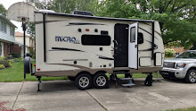
We returned to Sarah and Craig’s this morning after finding the fold-out, tent-like play house we sought. With an attachable tunnel and Thomas the Train Engine on the sides it was a big hit. We chatted and played and had a bite of lunch before Ken and Jen took off for Howell. We stayed until the boys went down for their naps and then left. We had a sunny 50 degree day to drive in and it was all fine until, just short of the state line, we had another blow-out on the camper! Again we were lucky in that we were right by an exit so we got off the freeway and into a parking lot to open the camper and change the tire. I told Marv he was getting way too good at it! Back on the road we listened to MSU’s season ending game against Michigan, where we totally blew them out of the water. Bliss! We backed into the driveway just as the game ended. I ran in to turn up the heat while Marv unhitched the camper. Then we drove to Coral Gables to have dinner. When we returned we turned on the water and emptied most of the back of the truck before watching the Oscars and generally relaxing a bit. We had driven 7,612 miles through 12 states, spending at least a night in 6 of them. We averaged 16.2 mpg and saw gas for as little as $2.27 (when we had a full tankL) and paid as much as $3.06, but it was usually between $2.49 and $2.69. Considering the weather going on elsewhere, and before and after we visited several areas, we felt that we were pretty charmed for the whole trip. Two blown-out tires on the camper, both times in easy, safe places to replace them, were our only emergencies. We both agreed the trip was as good as or better than we had hoped, but perhaps not quite as much warm weather as we would have preferred. We will settle back into life here in East Lansing and enjoy what will hopefully be a LONG run in the Big Ten and NCAA basketball tournaments. I don’t plan on adding to this blog until the first full week of April, when we will be traveling to Hawaii with our buddies Kris and Heidi for her spring break. Do come back then to read the continuing adventures of The Savage Traveler.

Day 41--Indianapolis and Jordan's 2nd Birthday


Things went pretty much according to plan this morning and Marv got things emptied and dried to his satisfaction before we got on the road. However, we had forgotten that we would be passing out of Central Time Zone so we were suddenly an hour ahead of where we thought we were. We still managed to check-in at the Jamison Inn, drop the trailer, and get to Jordan’s second birthday on time. All of Craig’s family except his brother-in-law, Mike, and brother, Brian, was there. And all of Sarah’s family was there, along with a friend named Marie and her daughter, Claire. Cessa and one of her divers also dropped by, having dropped off her special Elmo cake before practice. A wonderful time was had by all and Jordan was a delight. He sang to himself and spontaneously wished himself Happy Birthday several times. He and Eli fought over who would play with the presents and he quickly figured out that, for one shining day, he could always count on being given priority. So he extended the privilege to pretty much anything Eli picked up. It was pretty funny. Craig’s family and the others all left before the boys went to bed, but we stuck around until about 11:00, with Ken and Jen staying in the guest room. It was so nice to see our family again!!

Friday, March 5, 2010

Day 40--finishing the Natchez Trace


Sadly, this was really the last day of our six-week adventure. Tomorrow we’ll be beating a fast path to Indianapolis, with no interesting stops along the way. We had over 200 miles left to drive on the Trace, so we got on our way close to 8:30. It had been another cold night, down in the twenties but it went above freezing as soon as the sun rose. Today we learned that President Jefferson ordered the army to clear the Natchez Trace beginning in 1800 because Mississippi seemed so remote that the government was afraid that it would decide to become a separate country. The Trace was meant to serve as the postal route, along with continuing to be a return route for “Kaintauks” who had floated a cargo of goods down the Mississippi to Natchez, sold the boat as lumber and were heading home. We also learned more about the Chickasaw and Choctaw tribes who controlled most of the lands the Trace crossed. We drove out of Mississippi, across the corner of Alabama and into Tennessee over the course of the day. Among other things we saw today was the grave of Meriwether Lewis, who died from two gunshots (most likely self-inflicted) at Grinder's Stand. It was so interesting to see the insignia for the Lewis and Clark expedition with which we became so familiar on last summer’s trip. But it is sad to think that he died in so remote a location, on his way to Washington, DC to defend his government expenditures for the expedition (he was cleared of all charges posthumously). We stopped at several Paleo-Indian Mound sites, some from the time of Christ. How strange to think that there were thriving communities of natives trading over thousands of miles for copper, flint and shells at the same time and longer ago than Jesus! We took a few opportunities to walk again on the original Trace where it has been maintained as a pathway. At our final stop we came upon an armadillo, peacefully rooting beside the trail and hardly concerned about our presence. We passed over the award winning bridge spanning Birdsong Hollow and shortly after reached the end of the Natchez Trace Parkway. What a jolt it was to return to an interstate with its traffic and billboards and big trucks racing! We went around Nashville and got to Bowling Green, Kentucky, our twelfth state of the trip. There was a KOA close to the freeway where we could have electricity for the first time in three nights, and Wi-Fi for the first time in a week or more. We’ll empty the trailer of all water in order to get back to the frigid north this weekend.

Day 39--Day 2 on The Natchez Trace


We have definitely left the warm weather behind us now, but at least every day is sunny with no sign of clouds. Last night it got down in the twenties as the heavy frost on the truck windshield attested. We had a warm bowl of oatmeal and took down the camper before driving a short ways (part of it along the old Trace itself) and taking the trail through the ghost town of Rocky Springs. It was hard to believe that two old rusty safes, a couple of rock cisterns and a lovely brick church are all that remain of a thriving rural community of 2600 back in 1860. Yellow fever, poor land management, the Civil War and boll weevils all conspired to wipe out the town, with the last store closing its doors in 1930. The church, built in 1837, is still used every Sunday and the doors are left unlocked, inviting people to stop by and look around, which we did, of course. Then it was time to head up the Parkway to go to Vicksburg to see the National Battlefield. We wasted some time frogging around when we should have followed the signs to Tourist Information but it all worked out okay. We went to a private Battlefield Museum first which was so-so. Then we went to the National Battlefield Visitor Center and learned the story of the siege of Vicksburg, which gave the Union control of the Mississippi, so crucial to winning the war. Lincoln said, “Vicksburg is the key…we cannot win without the key in our pocket.” With the story firmly in mind we took the auto tour of the area and could see the remains of the trenches and bunkers of each side. It was time to get back to the Trace so returned and continued north, stopping to have our picnic along the way. We talked to a couple from Minnesota with an Airstream who invited us in to see it. They were also hoping to camp tonight at Jeff Busby campground. We didn’t make as many stops as yesterday, wanting to get to the campground in time to enjoy the nice (mid fifties) day. We picked out our site and left the camper without setting it up. We hiked about a mile up the road to Little Mountain lookout, at 605 feet one of the highest points in Mississippi and the highest along the Trace Parkway. It was a great view to the east and the west. We found that there was a hiking trail through the woods leading to the campground. So we took it back and came out right down the hill from our campsite. We set-up the camper and had soup for dinner. Our provisions are running pretty low but since we’re at the end of our trip, we’re making do so we don’t end with lots of food. But tomorrow night we’ll need showers and Wi-Fi so we’ll pick our campground accordingly.

Day 38--Beginning the Natchez Trace


We headed out first thing this morning and, after nearly 4 weeks of exploring it, we bid farewell to Texas. We had traveled nearly the entire Texas portion of I10, which is about 880 miles, underscoring just how big the state is. We took lesser highways on a diagonal across the lower half of Louisiana, coming out at Natchez, Mississippi. After a stop at the visitor center overlooking the Mississippi we drove around the town a bit, marveling at some of the large old mansions. By about 2:00 we looked for the Natchez Trace Parkway. We took a wrong turn and went under it then returned to town and found the beginning so we could truly say that we drove the entire thing. And what a pleasure it’s going to be! The Parkway is administered by the National Park Service and is two-lane, limited access, running parallel to the original Natchez Trace. It is closed to commercial traffic and we experienced practically no other vehicles the rest of the afternoon. There are numerous historic sites the whole way and we stopped at pretty much each one, including the Emerald Indian Mound, two places where one can walk in the old Natchez Trace and other interesting places. When we stopped at Mount Locus, the oldest and only remaining Inn (or stand, as they were called) we toured the restored building and talked to two volunteers who told us that the three campgrounds along the Parkway are free (the good news) but that we were probably too late in the day to get a campsite (the bad news). They said they fill up this time of year with Canadians heading home who stop at each campground and stay for the 14 day limit before moving on. We continued on with trepidation, stopping only to walk in the Trace where it was worn down thirty feet deep. When we stopped at the first campground, Rocky Springs, we were thrilled to find that, far from being full, there were only two campsites occupied other than the host site! We took an easy, level, pull-through site near the bathroom with no one around us and didn’t even unhitch the trailer from the truck. We set-up and warmed up leftover chili (stretched with leftover spaghetti sauce and leftover baked beans) and settled in for what may be a cold night, with no electricity to run one heater, but the gas furnace to help keep us warm.

Day 37--Hiking in Big Thicket


We spent all day today exploring and hiking in The Big Thicket. We started the day with breakfast out at a small Waffle House in Lumberton. Then we began, as usual, with a stop at the Visitors’ Center, watching their video and looking at the displays. The Big Thicket is an amazingly diverse community of different ecozones, animals and plants. Organisms forced south by the glaciers adapted and stayed in this one area so that you have northern bluebirds living among roadrunners and bald Cyprus mixed in with northern holly and beech trees. It was so dense originally that no one settled there until the early 1800s, when southeast Native Americans were forced to relocate and so they found ways to adapt and thrive. The Ranger talked to us about the trails available and said that only one of them is open to bikes. That one has been closed for hunting season and she wasn’t sure about what kind of shape it would be in since it just opened yesterday. She also warned us that the trails were prone to flooding, just like at the State Park, where their trails are pretty much inaccessible because of the rain yesterday and last night. Nonetheless, we managed to hike to our hearts’ content. We went to Kirby Nature Trail, which has interpretive signs along much of it. We took the Cypress Loop, walked partway along the Turkey Creek trail and then took the Outer Loop for about a 3 mile hike altogether. It showed us parts of four of the ecozones in the preserve: forested slopes, acidic baygalls, flood plains and cypress sloughs. Then we took the half mile Pitcher Plant Trail, which leads through a mixed pine forest and across the corner of a wetland savannah, with four of the five kinds of carnivorous plants found in North America; it is missing only Venus Flytraps. Most prominent are the Pitcher Plants which are easy to spot, even though many were looking pretty sad from a recent frost. Finally, we took a 2-3 mile hike on Nature Conservancy Sandhill and Interpretive Trails. It took us across the sandy upland terraces of a longleaf pine sandhill community. Like the Big Thicket, the area is being restored and managed through a long-term program of prescribed burning and selective removal of introduced slash pine. Walking the trail, it was easy to imagine that we were walking in a sandy northern Michigan white pine area. However, the ground cover includes Louisiana Yucca and prickly pear. And the longleaf pine begins life as what appears to be a tall tuft of grass before it grows a deep taproot and then grows several feet taller each year. The needles (leaves) are up to a foot long and the cones are quite large too. It was interesting to see how it differs from pines with which we’re familiar. We also saw what appeared to be footprints in the sand of perhaps a mother black bear and a cub or two walking beside her. Tired from all that hiking we redeemed our Blizzard coupons, bought bread and milk, and returned to the campsite for a dinner of pork chops and sweet potatoes.

Day 36--Big Thicket National Preserve


The predicted rains came earlier than expected and continued off and on all night. But thankfully they were finished by day break and we had no trouble breaking camp and getting on our way by 9:15. We dropped out of the hill country and by the time we got near Houston we were back at sea level and traveling across pretty boring, flat land. We also seemed to catch up to the rain. After being in the mid-sixties and mostly sunny we found ourselves back into wet pavement and low fifties by lunchtime. We ate in the truck and then went into a McDonald’s for coffee, a break and the Wi-Fi. We checked quickly to find that MSU had beaten Purdue on Sunday (hurray!!!), update the blog (with no pictures because it was VERY slow), and read email. We got back on the road and arrived at Village Creek State Park by about 4:00. The park is so far east it is nearly in Louisiana, very small and its trails are mostly flooded right now. There are only 3 or 4 sites taken in the electrical loop and no one in the tent sites. But it is in the middle of “Big Thicket” country, with the Big Thicket National Preserve just down the road. So we’ll spend most of tomorrow exploring and hiking there. I’m getting a kick out of hearing and reading about the Piney Woods in which we’re camping. One of my favorite books to read to my classes each year was A Week of Raccoons. In it the frustrated old man took his live-trapped raccoons on a long ride to be released in the Piney Woods. Now I know what that is!! You gotta love a place that calls its special places names like Big Thicket and Piney Woods!

Monday, March 1, 2010

Day 35--Austin, TX: Happy Birthday, Ken!!!

Today was supposed to be our chance to see Matt and Dean Hubbard, which didn’t work out, but more on that later. We drove to the Austin area, which took about an hour and a half. Since it was sunny and in the mid-sixties, we decided to go to McKinney Falls State Park first. That was a great decision. We hiked around the lower falls first, then drove to the upper falls and ate our lunch sitting on the limestone ledges at the falls-edge. Afterwards we went through the exhibits at the Visitors’ Center and took the one mile interpretive trail that led to a natural rock shelter carved by the creek and used a thousand years ago by prehistoric natives. We found we were pretty close to our next destination—the Lyndon B. Johnson Presidential Library. We felt like we didn’t need to spend a lot of time there since we had already been to the historic park, but we enjoyed the displays and watched the film about his life. While we were there I got a call from Matt, who had just returned from playing in Houston this weekend. It was hard to understand him because I was inside a large building, but he said that he was “on call” for recording and someone had just come to town and wanted him badly enough that he was paying $1000 to record. Needless to say, we couldn’t compete with that. So we settled for going through the Texas State Capitol, which we suspect was designed by the same man who did Michigan’s. We’ll check that out as soon as we have some internet access. The Capitol was renovated in 1997 and is very lovely, reminding us very much of ours. We drove back to the campground and had a late dinner and did as much as we could to prepare for leaving tomorrow, in case the predicted rain does arrive.

Day 34--San Antonio, TX

Another very full day! We rode our bikes about .6 miles to take the 9:00 hike at Honey Creek Natural Area. This protected area can only be entered when you are with a guide. It was sunny and in the high forties when we started but warmed up nicely the whole way. The guide shared some of the history and ecology of what was a German farmer’s land in the early 1900s. We walked to the bluff overlooking the Guadalupe River and then descended to the bank of Honey Creek. The creek is only about 3 miles long from where it comes out of the aquifer to where it meets the River. In between it actually retreats back underground in a few places so that it looks like the creek is dry. But where we saw it, the area is called a Palmetto-Cyprus plantation. It fit my idea of a sylvan glen. The clear green-blue water bubbles and gurgles over a limestone bed and one can see small fish in the calm areas. We climbed back up to the savannah and then rode our bikes back to the campsite. Then we made the drive to San Antonio. After parking on Houston Street we walked to the Alamo and wandered around what remains of the old mission. We continued on to the Riverwalk, joining it about midway along the canal. We walked all the way to the San Antonio River and then back the other arm of the canal. We stopped at a quiet table in the sun to enjoy a lunch. After we were seated we heard from the water taxi drivers that the small island near us is called “Marriage Island” because so many people choose to be married there. Sure enough we realized that a small group of 15 people or so was gathering and, as we ate our lunch, a couple about our age was married, with their children standing up with them. How romantic! We finished walking the canal, cut through the large riverside mall, and returned to the truck. We drove past the Governor’s Palace, which appeared to be closed and then to the Farmers’ Market but, since parking was such a hassle and so expensive, we opted not to stay and instead drove back to the campsite. There we sat in the 68° sunshine and read for an hour or so. Then we rode our bikes around the other camping loop, just to see it. After a chili supper we had our first campfire of the trip. Most of the campgrounds we’ve been in have not allowed any ground fires at all. It was a perfect night for a fire, with clear skies and a full moon, no wind to blow the smoke around and temperatures in the high forties. After S’mores (with peanut butter, of course) we watched the USA take the gold in bobsled and hit the sack.

Day 33--San Marcos, TX

Today was our chance to get together with Laurel and Andy in San Marcos. The GPS took us via some FM “Farm Routes” through the rolling countryside. We saw alpaca, miniature horse, and quail farms on our way. Part of the time we drove along the top of a ridge with spectacular views to each side. We met Laurel, Andy and Nathan at their house. After chatting for a few minutes we took their van to pick-up Anna at her preschool. Andy drove through some of the old neighborhoods of San Marcos and past the Texas State University campus and then went on to the small town of Kyle. We stopped at the Railroad Bar-B-Que for a great lunch of brisket and sausage with their yummy sauce. The restaurant is in one of the old railroad buildings right on the tracks and there is nothing fancy about it with its long picnic-style tables, rolls of paper towels and walls hung with old license plates, which added to its authenticity. It’s just exactly what we like to do when we’re exploring a new place! From there Andy drove us to the back gate of his grandparents’ 300 acre ranch along the Blanco River. His affection for the area was very evident as we drove along the two-track, spotting deer along the way. We drove to the Blanco Chapel on the ranch property. It was built in 1865 and served as a combined schoolhouse and chapel in the area. Andy’s grandparents were awarded a state recognition for their restoration of the building. A family Christmas celebration is held each year and several of Andy’s cousins have been married there. It was a beautiful, sunny day but the temps were in the high 50s with strong winds so we didn’t linger long. We returned to the house so Andy could pick up their friends from Seattle, coming for the weekend, and we left at the same time, taking with us a large jar of Laurel’s homemade granola. We took a slight detour to drive to Blanco River State Park. The green-blue water must be very inviting on a hot summer day, but we weren’t enticed. Nearby we found a Laundromat with a strong Wi-Fi connection and car wash so we could take care of two tasks we needed to do. We got back to the campsite just before sundown for another light supper.