Sunday, June 30, 2013

Out West Adventure: Part 2--Traveling to the Olympic Peninsula

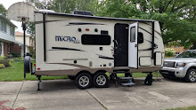
Thu. June 13: It rained more during the night and was drizzling when we got up but it soon stopped and was just dripping. Still, we decided there was no reason to drive to nearby Mount Rainier National Park, if we weren’t going to be able to see anything. Instead we headed up I5 until we exited on US 12, where we stopped at a McDonalds and looked for camping on the Olympic Peninsula. We followed US12, which starts in downtown Detroit, to its end in Aberdeen. Then we got back on US 101, the same coastal scenic drive we had traveled in Oregon and followed it up to Forks, where, after eating lunch at “The In Place”, we found a camping spot at the Forks Hwy. 101 RV Park. It’s right in town but is surprisingly quiet and from here we can do the east side of the Olympic Peninsula. After setting up we got back in the truck and drove to Mora Rialto Beach to walk along the rocky shore amidst the giant logs of driftwood while waves crashed. We decided the wild Pacific shoreline would be a good place for an impromptu dinner so drove back to a resort/restaurant/campground/store where we bought Wheat Thins and a 6-pack of cold Fish Tale Amber Ale from Olympic Brewery. The woman who served us had a “no vampires” shirt on and I asked what the deal was with all the vampire and werewolf references we were seeing. That’s when we learned that the Twilight Series of books and movies were set in this area of Forks and the nearby Quileute/Quillayute Indian village of La Push, and that the wedding in the movie was filmed right at the campground here. 


Washington Coast

Beach strewn with giant driftwood 

Marv on a tree larger in diameter than he is tall

Cobbled Beach

We drove to La Push, where there has been a Quileute Indian Fishing and Whaling village for thousands of years, and bought local smoked salmon from one of the houses in the village housing area. Then we drove partway up a hill and parked the truck. We took our cooler bag and hiked up, up, up what would be a dune along Lake Michigan, through a lush and primeval forest and then down, down, down, down 156 steps to the shoreline where there was a sandy beach. We sat on a big log and ate our fish and crackers and drank a beer while the quieter waves rolled in to the protected cove and eventually had the whole beach to ourselves. The sky had clouded over so we didn’t stay for sunset. The hike back was a bit easier since we now knew what to expect and at the parking area we read the sign that told us that it was a ¾ mile trail to the beach. As we drove the road back to the RV Park a critter trotted across the road in front of us. We both got a good look at it and can only think that it was a mountain lion that somehow lost most of its tail, giving its hind quarters the look of a bobcat. But it had the snub nose, tawny, sleek coat, and long legs of a mountain lion. Back at the camper we struggled with the shaky internet but got a few things done before bed.


The tree looked like a saguaro!

The 2nd beach, where we ate our dinner

Tenacious trees growing from a rock outcropping

Marv nears the top of the trail

Fanciful tree shapes

I called this one "The Womb"

Out West Adventure: Part 2--Mount St. Helens

Wed. June 12: On our short drive from Portland to Seaquest State Park in Washington, just off I5 and on the way to Mount St. Helens, we had a nice phone conversation with our friend Jessica Martinson’s dad, Bob. He and her mom, Suzanne, live in Longview, where Jessica was born, thought they have all lived elsewhere in between. More importantly they were living there when Mount St. Helens erupted in 1980 and Bob was working was on the local newspaper team that won a Pulitzer Prize for their coverage of the eruption. He was very gracious and invited us to stop by but we knew we needed to get there and get set-up in order to have enough of the day to explore the area. We took a nice site with no electricity at the campground and left the camper without setting up. Our first stop was at the Mount St. Helens State Park Information Center across the highway from our campground. But they charged admission for their displays so we decided to wait on that. It was a 54 mile drive to the Johnston Ridge Observatory in the Mount Saint Helens National Volcanic Monument (or MSHNVM). Much of the way it was pretty cloudy and we decided that we should take pictures any chance we had any view of the mountain at all because it might not get any better. Along the way there were other museums and visitors centers, including one by the Weyerhauser Corporation overlooking the wasteland left by the huge mudslide that rushed down the Toutle River after the eruption. There are frequently elk herds roaming in the valley but we didn't see any when we stopped there to eat our picnic lunch. As we drove through that area, about 20 miles outside the monument, there were interpretive signs telling when we entered the “Blast Area” and explaining Weyerhauser’s plan for managing the forest by harvesting some of the fallen old growth trees that weren't incinerated and then skipping a few forest succession steps by replanting the hillsides with pine trees. 33 years of growth has resulted in the reforesting of many miles. This is a real contrast to the Monument, which was set aside by Congress to allow the scientific study of how Mother Nature would replenish and rebuild in her own way. The land on the outskirts of the Monument has gone through several stages of wildflowers and now is heavily covered with alder trees only a few years old. Closer to the mountain, where the blast literally scraped the top soil off down to the rock there is still a lot of totally barren ground. The fabled beauty of the symmetrical cone-shaped Mount Saint Helens has given way to a stark but utterly fascinating landscape unlike anything else we have seen. The Observatory/Visitors Center is very well done and combines the scientific data and information on what occurred on May 18, 1980 (only the most recent of its many eruptions) with the human interest stories of those who lost their lives, including the young volcanologist for whom the ridge is now named, or who barely escaped with their lives. We spent a couple hours there going through their exhibits; watching two movies, one on the eruption and one on how nature is restoring the area; and heard two ranger presentations, both expert and very rapidly and dramatically done. While we were there we got some views of the mountain that were nearly clear of clouds and then fog, rain and clouds rolled in, almost completely obscuring any view. We took two short hikes in the 42° drizzle and made the return drive with rain most of the way.  
Just inside the blast zone they've built this new bridge


Mount Saint Helens' new look

Penstemon was flowering abundantly

A picture of a wet display board showing Mount Saint Helens on a clear day

Trees still lie upon the ground on Johnston Ridge where the blast tore away everything down to bedrock 

The clearest shot we had of the new crater 

A picture of how the old Mount Saint Helens looked

Back at the campground the rain had stopped. We ate Teriyaki Rice with ground beef and salad. Then we took about a two mile hike down to the Information Center and around the wetland trail there. It was very quiet and peaceful with many frogs and birds calling as twilight fell. In the camper we watched a Northern Exposure and cuddled under the MSU fleece blanket Jen made us to stay warm. 
From the wetlands trail


Out West Adventure: Part 2--Portland

Tue. June 11: Our final day in Portland was dedicated to “doing Portland”. With way too much frogging around we finally drove ourselves to the Portland Rose Garden and the Japanese Garden, both of which were stunning. The roses were overwhelming and that garden is free to one and all. The sun was in and out and we had some very light drizzles all day long with temperatures around 61°, so we were just as happy that we had spent the other, nicer days doing what we did. We had hoped to park at the Zoo and take the TriMet train to downtown, but that wasn't possible. I finally called the TriMet phone number for “Plan Your Trip” and found out that we could have started the day at a Park & Ride in Clackamas, about 8 miles from the campsite. Oh man…. As it was, we drove there anyway, bought our All Day Pass for $5 each, and rode the green line down to The Pearl District. First we found the Deschutes Brewery and Public House for a very late lunch of a Quinoa & Cashew Vegan Burger and a pint of Nitro Stout (me) and their Burger and a pint of IPA (Marv). Both of us were happy with our choice. From there it was only a block walk to Powell’s Bookstore, which takes up the entire block and is four stories of new and used books. We wandered around exploring for quite a while and bought a used book on the northern Rockies. Nearby we caught the Portland Streetcar (which until a year ago was free fare) and rode down to South Riverfront. And then we walked---from South Riverfront along the Willamette River to North Riverfront to Old Town/Chinatown back to The Pearl and on to Union Station where we caught the green line back to Clackamas City Center. We printed some pictures at a Rite-Aid to send as postcards and tried a quick stop at McDonald’s to download Lansing State Journals but didn't have much luck. So we returned to the campsite and had the leftover Bar-B-Que on bread with veggies, did the dishes one last time, wrote our postcards and began to pack to leave Portland in the morning. 


Iris in the English Garden next to the Rose Garden

Calla Lilies in the English Garden next to the Rose Garden remind us of Sarah


Zen Garden in the Japanese Gardens

Japanese Gardens

Deschutes Brewery and Public House

China Town gates

Out West Adventure: Part 2--Mount Hood and the Columbia Gorge

Mon. June 10: Monday’s track took us east and north to do the Mount Hood/Columbia River Gorge circle. The route to Mount Hood was right outside the gate of the park so after toast with peanut butter and a glass of milk, we were on our way. It was cloudy and cool when we left and we feared we wouldn’t be able to see Mount Hood from a distance nor anything from there. But the sun came out as the road climbed to over 5000 feet and then we took the spur to Timberline Lodge at 6500 feet, where there was still snow on the ground between the trees. Then we were in for a very pleasant surprise. The historic lodge is the hub for a year-round ski area. We parked the truck and, finding that they had an 11:30 Buffet Lunch we decided to fill our time until then. We hiked partway up a trail that was mostly gravel and clear of snow but lead to the bottom of the ski runs. High above us we could see a chair lift running and tiny dots of skiers and snowboarders beginning their descents at 8500ft. There are no trees at that level—just the hard packed snow field. Further up, we could barely make out a few hikers climbing to the summit. After a while we went into the Lodge and watched a video about the building of the magnificent building. It was a WPA project, which used Arts money so was built by craftsmen and used a gifted female Interior Designer from Portland. Always administered by the Forest Service, it was mismanaged and fell into disrepair in the fifties before being resurrected and refurbished by a local businessman. Now it is a beautiful and successful year-round facility. We found a ranger giving a tour of the building so we added on to that and learned more about the Lodge, the most recent eruption of Mount Hood about 220 years ago (just before Lewis and Clark arrived), and the area before we had the wonderful lunch. Our window table looked south to Mount Jefferson and The Three Sisters in the distance. The food was local and delicious so we were stuffed by the time we left. 
Mount Hood ahead!

Coming closer...

Timberline Lodge

Tiny dots in a line are the ski lift supports

Marv "on the slopes"

Ranger explaining the Lodge's history

Mount Hood from the north side


The road descended going north, giving us nice views of the other side of Mount Hood and Mount Adams in Washington, and took us to the Columbia River where we visited first the Cascades Lock, which was built in 1896 and is now mostly underwater, the Bonneville Lock, built in 1938 and no longer used, and then the Bonneville Lock and Dam, built in 1993. There is a nice Visitors Center which explains both the locks system and the hydroelectric capacity and has an underwater viewing/counting station for one of three fish ladders to facilitate migrating salmon and steelhead. I got a few more stamps for the Passport there, including another Lewis and Clark stamp because they traveled the area and included the Cascades in their Journals. The Cascades were caused by two mountains on the Washington side that had such giant rock slides 350-700 years ago that they actually dammed the river and caused a bridge across the Columbia that is included in the oral history of the Chinook Indians, who called it the Bridge of the Gods. Eventually the mighty river worked its way through the dam and carried the rocks downriver forming the cascades or rapids for many miles.
Bonneville Locks and Dam

Fish ladder beside the dam

 From there we picked up the Historic Columbia River Highway. Old US 30 connects Dobson and Corbett and from it one can view 5 different waterfalls cascading over the walls of the Gorge. We stopped at each one and walked about 3 miles of trails to see Horsetail Falls and Upper Horsetail (or Ponytail) Falls, Multnomah Falls, Wahkeena Falls, Latourell Falls, Crown Point Vista House, and Women’s Forum Overlook. Somehow we missed Bridal Veil Falls but we were satisfied with what we had seen. We had almost come full circle and the GPS told us how to complete the journey, taking us past 20 miles of orchards, berry farms, and doggie spas and back to the campground. The spaghetti sauce we had left in the mini-Crockpot was ready but we still weren't very hungry after our big lunch. So we both took showers before we had salads and a small serving of spaghetti, leaving enough for another dinner. It had been an even better day than we had hoped for and the unexpected addition of Mount Hood to our plan was a wonderful success. 
Horsetail Falls

Upper Horsetail (or Ponytail) Falls from behind

Multnomah Falls

Wahkeena Falls

Latourell Falls

Looking up river from the Vista House

Looking down river from the Vista House

Historic Columbia River Highway

Monday, June 24, 2013

Out West Adventure: Part 2--Lewis and Clark make it to the mouth of the Columbia River and so do we

Sun. June 9: A phone call first thing in the morning revealed that our suspicions of the night before were correct. Today’s technician connected us for another month and we were back in business. I put boneless pork short ribs sprinkled with garlic powder and seasoning salt in the mini-Crockpot and Marv made wonderful cinnamon-apple-oatmeal pancakes by adding an envelope of instant oatmeal to our whole grain pancake mix. Delicious!! Then we were on our way to the far northern Oregon Pacific Coast. Today’s goal was to visit most of the sites in the “Lewis and Clark National and State Historical Parks”. And we did a pretty good job of it. What we didn't realize until we were underway was that the area was over 100 miles from Portland, back through the Coastal Ranges and to a pretty remote area. But we had all day to explore and with our interest in history in general, and Lewis and Clark in particular, we had a good time. Through the day we managed to visit 1) The Salt Works, where 3 men boiled sea water 24/7 for 6 weeks to get a bushel of salt to replace the depleted stores; 2) Fort Clatsop, named for the local tribe from which the explorers took the land to build a fort to get them through the winter, there is now an Interpretive Center with two films, one telling the story of Lewis and Clark’s arrival from the natives’ perspective, and the rebuilt fort; 3) Netul Landing, where the party landed after a pretty disastrous two weeks on the north short of the Columbia River; 4) Dismal Nitch, where the party had to wait out a fierce November storm that pinned them to shore for six days with little food and worn out clothing; 5) Station Camp, where they moved to when the storm ended and what Clark used as a point from which to make many of his surveying marks; 6) and the lighthouses and interpretive center at Cape Disappointment, where Lewis and Clark first looked over the Pacific Ocean. We took our time, ate a light picnic lunch, took several short hikes, and got seven Passport Stamps in our book. When we finally returned to the campsite it was dusk. I pulled the pork and added bar-b-que sauce while fresh sweet corn cooked in the microwave. With salad and a cold beer, we had a feast!
Tunnel through the outcroppings along the Oregon coast

Mount Hood in the background, Willamette Falls in the foreground

Lewis and Clark salt works

Fort Clapsot

entry gate

Chinook Indian fishing boat


Fresnel lens at Cape Disappointment center between two such lights