Thu. May 23: We had some frustrations
Thursday morning trying to get out of town, which made us feel like we weren’t
going to have much luck finding a campsite near Sequoia National Park for
Memorial Day Weekend, about an hour and a half beyond Bakersfield. The whole
area was agricultural with dairy farms, orchards, vineyards and lush oleander
everywhere. But the roadsides and hillsides beyond were brown and parched attesting
to the irrigation that is fueling what opened into the San Joachim Valley
farms. Marv had studied the literature and hoped to get a spot at Horse Creek
Campground, an Army Corps of Engineers park on the shores of Lake Kaweah, a
reservoir behind a large dam. When we arrived about 11:00 we saw a nearly empty
campground and thought we were golden. Then we talked to the ranger and found
out that it was 95% reserved for the weekend. But we did manage to find the
last site on which we could fit the camper. What a relief to be so nicely
situated about 8 miles from Sequoia for the whole weekend! After setting up and
eating lunch we drove to nearby Visalia to get some groceries, do some banking,
and buy fresh, local strawberries and cherries. Before returning to the
campground we stopped at the small but nicely done Lake Kaweah Visitors Center
that told the story of the dam and why it was needed. The volunteer warmed to
us as she saw we were genuinely interested and gave us a lot of information on
the area. She explained that the reservoir is extremely low because it was a
light snow pack this winter and said that usually most of the campground we’re
in is underwater until July or so, when they are releasing 3 feet of water per
day from the reservoir. The farmers down in the valley are having to dig deeper
and deeper wells and the situation is becoming pretty dire. When we did get
back we found that a few campers had joined us but our high campsite has us
well removed from others. We are just a few yards down the hill from the road
but the traffic on it became lighter and lighter as it got later. And the site
is full of datura (aka moon flower or angel’s trumpet). The temperature which
had been in the low eighties dropped into the fifties as the nearly full moon
rose.
 |
| Marv's View |
 |
| View of Marv |
 |
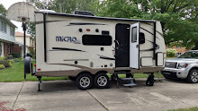
| Campsite |
 |
| Sunset over the reservoir |
 |
| Full moonrise behind us |
Wed. May 22: We had a good night’s sleep in the silent campground where the temperature only got down to the low sixties. We packed up and got on the road heading to Bakersfield, only about an hour and a half from Red Rock Canyon. We needed to get the truck’s tires rotated and oil changed so wanted a big enough city to do that. We quickly descended from the Mohave desert with Joshua Trees in bloom or with fruit pods, past the largest area of wind turbines we had seen yet, into lush, artificially green agricultural land. The roads were soon lined with oleander in shades of red and pink and white. As we neared Bakersfield it occurred to me that Jamie Slater might live here. I checked Facebook and was soon in contact with her to meet for dinner. We found the River Run RV Park, which turned out to be a very nice private park, across the dry bed of the Kern River from the Bakersfield Bike Path. Marv spent several hours getting the truck taken care of while I used the excellent WiFi connection to get caught up on the Blog. Then we rode our bikes for 7+ miles on the bike path before meeting Jamie and her fiancé, Aaron at one of the Lengthwise Brewery restaurants in town. We had a delightful evening of catching up with Jamie and getting to know Aaron. The RV Park had filled up some since the afternoon but it was completely quiet as we went to bed.
.JPG) |
| Just a few of the wind turbines east of Bakersfield |
.JPG) |
| Add caption |
.JPG) |
| Add caption |
.JPG) |
Peggy, Marv, Jamie and Aaron
Tue. May 21: After an
amazing night’s sleep, where the temperature only got down to about 65° and a
single sheet was plenty to stay cozy, we lingered a bit in our campsite. The
sun started warming the camper about 5:45 and Marv started the coffee a little
earlier than usual because we were awake anyway. Yogurt and coffee were enjoyed
sitting in our chairs, entertained by the local wildlife including several
friendly chipmunks, a packrat, a jack rabbit, a lizard, a hummingbird, and assorted
little birds of other kinds. Without hurrying we had the camper put away and
were on the road before 10:00. Taking 215 and then 95 took us north of the Las
Vegas traffic, though we could clearly see the now familiar skyline of The
Strip. After driving the rest of the morning, stopping only for gas, we got to
Death Valley National Park by about 1:00. Coming from the east we stopped at
Zabriskie Point and climbed up a steep path about 100 yards to overlook the
Badlands of Twenty Mule Team Canyon. Although they only used the mule teams for
taking Borax out of the canyon for six years, they remain an iconic symbol for
Death Valley. As the temperature climbed to 100° we were happy to get back in
the car and drop, first to Sea Level and then below, and arrive at the Furnace
Creek Visitor Center. We stamped our passbook, watched their film, and went
through the excellent displays about Death Valley, learning that the Timbisha
Shoshone jointly manage the sacred, ancestral lands they call Tumpisa with the
Park Service. There was a picnic table
in the shade that a group of French visitors were just vacating to eat our
picnic lunch. We settled on a route through and out of the park, mutually
agreeing that it was too hot to take any trails. Hiking isn’t recommended between
May and September. Besides, the landscape is quite bleak in years, like this
one, when there isn’t enough rain for wildflowers. As we drove, the temperature
rose to 105° for a bit and then settled in about 102° while the GPS showed us
at 235 feet below sea level. We passed north beside the salt flats and turned
west past the sand dunes and then climbed steeply over 3000ft. with the truck
really struggling and getting about 5.7mpg. We rose over the pass and then
descended just as steeply into the Panamint Valley, which isn’t quite as low
nor quite as bleak but was just as hot as we drove out of the Park. There were
many more miles of the same bleak countryside. We stopped at a “Drive Inn” (no
curbside service) that had been there since 1958 for ice cream and found a bus
load of French travelers and heard the bus driver tell the girls at the counter
that they would be seeing him again this summer until October because he loved
to bring his people there and always would. Although we had heard at the Park
that all this land was BLM land and we could camp anywhere, it was very clear
that one wouldn’t want to a)pull off the paved road onto the gravelly, loose
sides or b)camp in 102° with no shade in sight. So we kept on driving. I found
that we could probably make it to a California State Park called Red Rock
Canyon and Marv had seen it earlier and thought it looked promising so we made
it our destination. There were some exciting short cuts and then we drove north
on 14 and entered a sloping, smooth canyon and found the park. There are many
campsites lined up along the edge of formations of loose, crumbly sandstone
with only a handful of campers. The office is only open on weekends so we found
a campsite much like the night before, tucked in beside what look like drip
sand castles, where we can’t see any other campsites. As we set up the camper
the sun went behind the rock hillside, the temperature dropped and the wind
blew so it was very comfortable. To get a little more exercise after our many
hours in the truck, we walked our registration about a half mile back down to
the entrance to put in the kiosk. I made big chicken salads for dinner and we
relaxed and planned for the coming days as the desert sky turned inky and the
half moon shone brightly down.


.JPG)
.JPG)
.JPG)
.JPG)
.JPG)
.JPG)
.JPG)
.JPG)
|


.JPG)
.JPG)
.JPG)
.JPG)


.JPG)
.JPG)
.JPG)
.JPG)
.JPG)
.JPG)
.JPG)
.JPG)
No comments:
Post a Comment