Tuesday, July 2, 2013

Out West Adventure: Part 2--Seattle Second Day

Wed. June 18: After a light breakfast of bread with peanut butter and coffee we went back to nearly the same place as Tuesday, parked the truck a few blocks away and this time walked up the hill a few blocks to the famous Space Needle from the 1962 World’s Fair. We had an early lunch at the revolving restaurant at the top, finding that, like in Niagara and Toronto, the high cost of the meal includes your ride up, which would have been $19.00 a piece alone. Marv had a King Salmon sandwich and split pea with ham soup and I had wonderful barely-seared tuna on greens with olives, peppers, green beans, tomatoes and carrots. We stayed for two revolutions and then went upstairs to the viewing deck for a little longer before going back down and returning to the truck.  From there we drove to the Pike Place Market area and found a pay to park on Pike Street and 5th. There was a bit of very light drizzle in the air as we made our way down to the waterfront. Along with the crowds of visitors we wandered through the famous market, watching the fish guys throw an order and buying a huge, beautiful bouquet to take to Heidi and a small bouquet of Sweet Peas for the camper. Then we went up on Queen Ann Hill to Kerry Park for the most famous view of the Seattle Skyline. It was mostly cloudy there and in the low seventies as it had been most of the time in Seattle so we couldn't see Mount Rainier but we still had a pretty good view over the downtown area and the harbor area at the bottom of Puget Sound. Since we still had much plenty of time we drove to the Crittenden Locks to see the fish ladder that allows salmon to travel up to Lakes Union and Washington. Nearby was Fremont with Theo’s Chocolate Factory. There wasn't room for us in the last tour of the day, but we went in their retail shop and found we could sample their wonderful and sometimes exotic chocolates to our heart’s content before buying one small but expensive salted almond dark chocolate bar. We then wandered for several blocks in a square partly along the canal looking in vain for a coffee shop. When we found that Peet’s Place was closed we reconciled ourselves to settling for Starbuck’s but as we went in I heard a man talking to two other men saying that the best coffee in the western U.S. was right around the corner at Malstead’s. So we went there instead and Marv had a freshly made French Press and I had a nice ginger-fig iced tea. It was 6:00 when we entered rush hour traffic to drive up to Heidi and Dan’s for dinner. We chatted over wine and beer and olives  before walking up the steep hill to Smith’s (voted #1 by Janice Oien) for a wonderful dinner with even more wonderful conversation, getting caught up on Heidi and getting to know Dan better. What a joy to interact as adults with good friends’ now grown children!! It was nearly 11:00 when Dan, with a twinkle in his eye, pulled out his credit card with a big block M on it. We all laughed when Marv pulled out his VISA card with the Sparty Helmet and MSU on it and they split the bill. It was midnight by the time we got back to the campsite but it had been a great last day in Seattle. 
Space Needle

Pike Place Market

Flowers galore at the Market 

Seattle skyline view from Kerry Park on Queen Ann Hill

Marv, Peggy, Heidi and Dan at Smith's

Out West Adventure: Part 2--First day in Seattle

Tue. June 17: We really did a bang-up job with two days in Seattle! It was about a thirty minute drive to downtown from our campsite and the GPS took us near our first stop, the Olympic Sculpture Park. We found a pay to park place on Western Ave. and wandered down the hill past the very modern works, each with an explanatory plaque with a statement from the artist. One new work is a rooftop coming out of the hillside and the artist was there working on completing it. She has done similar rooftops in several other locations around the world. We walked along the riverfront, past a large fountain, and back up another path with more sculptures before returning to the truck. The GPS then took us right to Ravenna Park, where we met Rachel Kabodian for some urban hiking. She guided us through the trails for an hour or so and then we went to one of her favorite vegetarian restaurants in the area, The Sun Light CafĂ©, where she and Marv had the tempe-burger and I had the hummus-avocado sandwich and we all had a side salad. YUM!! We all parted ways at Rachel’s bus stop and Marv and I drove back downtown and found a parking place near the Mariners and Seahawks stadiums. It was an easy walk up to the Pioneer Square area where we visited the Klondike Gold Rush National Park building. That was fun for us to see because we were at its sister/other half in Skagway, Alaska with Ann and Shelby in 2009. We walked around the area and across the square before returning to the same corner to a coffee shop with some WiFi for a little while. Then we drove back to the campsite ahead of most of the traffic to take showers and make tomato-basil soup and a grilled cheese sandwich to share for only the second vegetarian day of the trip. I find it’s pretty hard to get the supplies I need to cook vegetarian while camping. Wish I could do better. After dinner we rode our bikes down to the beach for a really nice sunset. We got kicked out of the closing day-use area before the sun was quite down but by then it had disappeared behind clouds and/or the Olympic Mountains so we didn't mind. Another Northern Exposure closed out the day.
Roof Sculpture at Olympic Sculpture Garden

Waterfront fountain by the Olympic Sculpture Garden

Peggy walking through large interactive walking sculpture

Wildflowers on the bank of the Olympic Sculpture Garden

Rachel Kabodian, Peggy and Marv hiking in Ravenna Park

Klondike National Park 

Seattle skyline

UPS 100th anniversary garden waterfall

Pioneer Square

Sunset over Puget Sound

Out West Adventure: Part 2--Going to Seattle

Mon. June 17: Monday we followed Hwy. 101 east towards Puget Sound and after some island hopping and bridge crossing we met up with I5 north. After passing Tacoma we got off near Des Moines and found Saltwater State Park. We were surprised to find it had no water or electricity and pay showers but it appears to be the closest public campground to Seattle so we can make do. There are only about 30 sites here but few were taken when we arrived so we got one close to the bathroom and got set-up. Then we rode our bikes the short distance to the day use area and its short, logs strewn beach. With temperatures in the seventies and lots of sun it made a pleasant place to sit and read for the rest of the afternoon. Marv grilled chicken while I made salads and sweet potatoes then we did some shopping and made plans for our time in Seattle.  
Going over one of the long bridges connecting islands

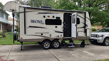
The inside of our TrailManor camper when it's set-up looking towards living room

The inside of our TrailManor camper when it's set-up looking towards the "bedroom"

Out West Adventure: Part 2--Our 40th Anniversary

FATHERS’ DAY AND OUR 40TH ANNIVERSARY!! We wanted the day to be special and it truly was. After scrambled eggs with lots of veggies and bacon bits we drove up Whiskey Bend Road to the trailhead at the end. The road itself is mostly one-lane and gravel but it’s pretty smooth and there are lots of turnouts for when one meets a car. Along the way there was a mama black tail deer with a tiny new fawn wanting to nurse right in the road! The road goes past the area where they are removing the Glines Canyon dam and we got glimpses of the work and the drained Mills Lake bed. The trail runs along the side of the very steep Glines Canyon and beyond what we had time or inclination to hike. We hiked for about an hour and then retraced our path enjoying the many, many wildflowers in bloom, the towering, moss laden trees, and the bird calls. The whole way we could smell Twinflowers blooming beside the path. Occasionally, the smell of roses would be stronger and then we would come upon a wild rose blooming. On our way out to an overlook we came across a small brown snake trying to find some warmth in a patch of sun in the middle of our path, so we carefully walked around her so as not to disturb her. When we had walked enough and turned around, we drove back down Whiskey Bend Road to the main road and stopped at Madison Falls. A short hike with our lunch bag and we had ourselves a lovely setting for our picnic on a bench beside the falls. Then we drove back west to Lake Crescent where we stopped and called Ken and Jen to check in on Fathers, Day and tried but didn't get Sarah and her family. So we went on to the Sol Duc River Road. 
Mama and baby

Giles Canyon Trail

Sunning snake

Mills Lake overlook

Glines Canyon overlook

Twinflower


The Sol Duc road runs right along the tumbling, glacial river and rises into the hills. We stopped to hike in to see Salmon Cascade, a narrow rocky passage where one can sometimes see the salmon fighting their way upstream to spawn. Farther up there is a Hot Springs Resort with two round, spring-fed, cement pools and one larger, rectangular, treated water pool. We hadn't brought suits and it was too late in the day to be worth the expense so we continued to the end of the road. There we took the hike to see the beautiful and thundering Sol Duc Falls. As we left the area we finally got a call in to Sarah and talked to all the kids who wished Boppa Happy Father’s Day and both of us Happy Anniversary. When we got closer to Crescent Lake we began a call with Marv’s Mom but it got dropped. We figured we had hiked 5 or 6 miles all day and had earned our dinner out. 
Sol Duc River

Salmon Cascade

Olympic Mountains in the distance

Upper Sol Duc River

Unnamed cascade along the trail

Sol Duc Falls

"Furry" Branches

We changed clothes in the truck at the Lodge and took a bottle of our Anindor Wine to the lakeshore where we found two Adirondacks with a table in between just waiting for us. The lake is glacially formed and narrow but 600 feet deep so it is a clear beautiful blue. Our chairs faced west as the sun got lower in the sky and interesting clouds played across the sky. When we went in for dinner we found they had reserved their best corner table for us, looking right over the spot we had just sipped our wine. Our waiter, William, was a Makah native of royal lineage who waits tables 4 nights a week just because he likes it and his wages go in his travel fund. He knew the place and the menu very well and made our evening enjoyable and memorable. We shared the wild mushroom risotto as an appetizer and then I had salmon from Neah Bay (where William’s family ruled) and Marv had duck. For dessert Marv had Marion berry crisp with Marion berry ice cream made especially for the Lodge and I had a Ghirardelli brownie with ice cream. It was the most expensive meal we've ever had but it was well worth it. It had been a wonderful and memorable 40th Anniversary!
Crescent Lake from the Lodge shore

A toast on our 40th Anniversary

Corner table at the Crescent Lake Lodge

Crescent Lake Lodge outside

Sunset over the lake


Out West Adventure: Part 2--North coast of Olympic Peninsula

Sat. June 15: It was only an hour or two over to the Elwha River campground off Hwy. 101 on the north side of the peninsula. We stopped to be sure we would be able to get a campsite when we arrived, and then again at the Lake Crescent Lodge to make a reservation for our 40th Anniversary dinner on Sunday. No sites were available right on the river but the 31 sites are stretched along two sides of a long narrow oval. By taking #30 we were very secluded but could hear the noisy rushing river very clearly and have glimpses of it through our windows. We have no electricity or water once again but the restrooms are recently redone and very nice, albeit with cold water only. The National Park has been working here for the past 4 years to remove two century-old dams, drain their reservoirs, and return the river to a viable salmon habitat. When the dams were put in they did not include fish ladders (although they were required by law) and so the salmon have been unable to migrate up river to spawn. The 108 foot Elwha Dam was removed in 2012 and Lake Aldwell has been drained and flow restored through that area. All but about 60 feet of the 210 Glines Dam has been removed and Lake Mills has been drained. Complete removal has been put on hold while corrections are made to Elwha Water Facilities and should be completed by September of 2014. Huge amounts of glacial silt have been released from behind both dams forming a new delta and many feet of beach. The river is still gray and thick with silt and they assume that most of the remaining 60 feet of dam is trapped silt. But the river will eventually work that through and again run clear and wild. The former dams and lake beds have been planted with 67,000 seedlings and over 2000 pounds of wild flower seeds. In the next 5 years 350,000 native seedlings and 5,000 pounds of seeds will be planted. And salmon populations will grow from 3000 to nearly 400,000. It’s quite an undertaking and the upper reaches of the Giles Canyon and Lake Mills area are closed completely until the removal is accomplished. It was a nice day with temperatures in the high sixties and mostly sunny so after setting up and having lunch we drove to nearby Port Angeles and up the steep winding road to Hurricane Ridge. From the ridge one has a great view up the Elwha Valley and across the heart of the Olympic Mountains, including Mount Olympus and its Blue Glacier. We got a passport stamp and watched their short video on the Olympic National Park. Part of the road is still closed for snow removal but we heard a ranger say it would be opening this week. The trails were also snow covered but we managed to walk their shortest path up the ridge, over some snow drifts, and past meadows of blooming wild flowers and browsing black tailed deer.  We tarried awhile, enjoying the warm sunshine and magnificent view before coasting back down the hill. We took a shortcut to get back to our campsite, the first half paved and the second half gravel but well maintained. We enjoyed being “off the beaten track”. We had chicken and angel hair pasta for dinner and watched a Northern Exposure before bed. 
Blue Glacier on Mount Olympus

Alpine lily

Snowy ridge with the San Juan de Fuca Bay in the distances


Hurricane Ridge 

Campsite at Elwha River

Out West Adventure: Part 2--Hoh Rainforest

Fri. June 14: Friday we did nature in the morning and anthropology in the afternoon. The National Park’s Hoh Rainforest area was just 30 miles south and then east of the campsite. After going through their Visitor Center and getting two more Olympic passport stamps we took their two nature hikes. One was the 1¼ mile Spruce Trail through a newer forest that is constantly changing due to the Hoh River that runs along it. The other was the ¾ mile Hall of Mosses. This higher, older, more established forest had many large Big Leaf Maples whose branches were hung with heavy drapes of moss. Both had large old growth Sitka Spruce, Western Hemlock, Douglas Fir, and the newcomer—Cedars. Throughout the forests we were serenaded by many Winter Wrens with their lovely, trilling song. The sun was out much of the time and the temperature right around 60° so it didn't seem much like the rainforest that it is. The area gets 142 inches of rain every year. The ground is covered completely with ferns and moss and other small plants. Tree seedlings can’t compete and so they have adapted to grow on stumps or fallen logs, which result in “colonnades” of trees growing in straight rows long after the nurse tree rots away. On our return to the center we asked many questions of the knowledgeable ranger, Corrine, and left feeling like we had learned a lot. I finally found out that the yellow flowered shrub we are seeing in heavy abundance throughout northern California, Oregon, and Washington is the highly invasive Scottish Bloom. As we drove out the park road we found a spot on the Hoh River to eat our lunch listening to the clatter of glacial cobble and rushing water.


Colonnade of trees 

Trees heavy with moss and lichen


More towering trees

Another lunch with a view


From Hoh we drove north and west about 60 miles to the farthest northwest point in the continental US at Cape Flattery. We stopped for a short time on the way to walk among the tidal pools at near low tide. The point is part of the Makah Indian Reservation and in the nearby town of Neah Bay there is a wonderful cultural museum, recognized by the Smithsonian Institution as one of the 10 best Indian Cultural Museums in the US. 500 years ago five or six longhouses in the ancient town of Ozette were buried by a sudden landslide. The thick mud served as a preservative for everything encased in it until the 1970s when a big storm washed some of the mud away exposing the artifacts. Eleven years of archeology and preservation have revealed elements of everyday life on the rugged Pacific Coast before the appearance of Europeans. Those artifacts are presented in a cultural setting complete with a reconstructed lodge, cedar canoes, woven baskets and much more. It is a fascinating and very well done museum where we lingered for an hour and a half or more. Then we drove out to the Cape Flattery point but hadn't bought the pass to take the hike out to the edge so turned back to try to find Pam’s Place for pie and Indian Fry Bread. On the way Marv noticed two Bald Eagles sitting by the river so we pulled over and took pictures of them and a movie as they took flight and disappeared into the tree tops. We never did find Pam’s Place so we drove back to Forks. Along the way we saw the hindquarters and tail of a river otter as it crossed the road and disappeared into the underbrush. We bought some groceries, took showers, and did two loads of laundry at the RV Park as we ate a late dinner of leftover spaghetti and salads. It had been another long but good day.
Trees clinging near the tidal pool

Pocked beach boulder

Bald Eagles

Close-up of Bald Eagle