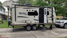
By Wednesday we were getting a bit
concerned about how our solar panel was going to keep up the battery on the
trailer with the lack of sun and the cool temperatures. Highs were hovering in
the fifties and lows were going down to the low forties, with the sun hiding
behind clouds much of the day. There was nothing we could do about it so we
went about our days with that worry at the back of our minds. We spent the day
driving 134 miles of the Apache Trail. A-88, also known as the Apache Trail, is
one of the most crooked roads in the nation.
It was named for the Apache Indians who helped build the very scenic,
winding road that ends at Roosevelt Lake. Following an ancient path through the
mountains, it was constructed to haul materials for Theodore Roosevelt Dam.
Along the way is Tortilla Flat, the only surviving stagecoach stop on the route.
A few miles east of Tortilla Flat the road turns into 22 miles of rough,
sometimes harrowing, gravel zig zags through the mountains. It is a trip of
unforgettable beauty as it winds through scenic desert mountain vistas, climbs
in hairpin turns, and finally plunges into Fish Creek Canyon.
 |
| Apache Lake narrows to more of a river just below the dam |
 |
| Looking back at Apache Lake |
 |
One really needs to drive the Apache Trail slowly and carefully;
one never knows what will be around the blind corners. |
 |
| Yep, that's our road way down there, disappearing around the hillside. |
 |
| The vistas along the Apache Trail are staggering. |
There are a
series of manufactured lakes and then the largest, Roosevelt Lake, the
reservoir for the Roosevelt Dam. We stopped at the Visitors’ Center for the Dam
and continued on the paved portion of the Trail with a stop at the Tonto Ruins
National Monument.
 |
| Roosevelt Dam |
 |
As you can see from the shoreline, the lake level is down considerably
from its usual. That surprised us because we had heard it was a wet winter
in terms of rainfall, but not in terms of snowfall in the mountains so the runoff
hasn't been filling the reservoir. |
 |
This bridge had to be added just above the dam when the dam's height
was increased in the 1990s. The original dam had a road across the top
to allow people to get from one side of the lake to the other without going around. |
At the monument we climbed the steep, steep paved trail up to see the
protected remains of a large cliff dwelling. We got to the historic mining
towns of Miami-Globe around 4:30 without having had lunch. There was an interesting
bar along Main Street in Globe where we thought we could get a late lunch/early
dinner. They claimed the best variety of craft beers in town, which may have
been true, but it turned out they don’t do food. We sat at the bar with one
other customer and the owner, who was happy to talk about her bar, which was
built in the early 1900s, and has the original wooden bar and cabinetry behind
the bar. It was really interesting and we enjoyed a beer before walking down
about 4 blocks to a local Mexican restaurant that our bartender said was good
and always packed. Since we were early for dinner, we had no trouble getting a
table and enjoyed delicious burritos. The drive home was mostly in the dark,
completing a very long and full day for us.
 |
| The dark cave in the center of this picture is the cliff dwelling. |
 |
Much of the ruins is original to around 1100 and we could still see
the hand prints in the caliche mud used to plaster the walls. Women
and children did much of the plastering and it was thrilling to see
the small finger and hand prints from 900 years ago. |
 |
They had a good view out over the valley towards what was then
only a river, but what is now Lake Roosevelt. |
 |
Several of the rooms are closed to visitors because they have original
floors or ceilings that are being preserved by the overhang of the cliff. |
 |
Rarely a saguaro will get a crested top like the one in the oval here.
Scientists don't really know why it happens but think it may be a
genetic mutation. We enjoyed watching for them throughout Arizona and
saw four of them; this one on the Apache Trail, one in Tucson, and two
of them off I19 on the way south to Green Valley from Tucson. |
 |
It is ingenious how stone age people used the walls of these natural
caves to build their houses so that they only had to put walls on one side. |
 |
The highway back to Apache Junction goes through deep cuts, with
towering walls on each side as we dropped over 1000 feet in a few miles. |


No comments:
Post a Comment