Tuesday,
October 16: Today we explored the west region of Iceland. It was very windy
(40-50 mph) with rain on and off. The country side is very different than the
South, less green and with larger expanses of land running to the ocean. The stunning
coastlines are deeply cut with fjords and we saw very, very few other cars on
the road. In the town of Borgarnes we visited The Settlement Center and learned
about the fascinating history of the country, mostly through their
spoken record of Sagas. The museum had two parts that we could explore at our
own pace with audio earphones giving commentary in English. The Vikings were
the first humans to discover and settle Iceland. Back then it was heavily forested,
but it no longer is. We were sorry to find out that Climate Change and warmer
waters have resulted in a steep decline in the sardine numbers. The sardines
need very cold water so they have retreated to the north side of the island,
therefore the iconic Puffins that used to reside on the west side of Iceland
are no longer seen here. We drove all the way out to Snaefellsjoekull National Park and then to the
town of Olafsvik (we figured out that “Vik” means town) where we got some
snacks to sustain us until we got back to the hotel. The glacier
(Snaefellsjoekull) was hidden in the clouds as we drove across the peninsula through
the mountains to return to the main highway. When we got back to the hotel we
found that, along with moving our stuff to our room, they had upgraded us to a
larger room. With the wonderful dinner we all enjoyed at the hotel restaurant “on
the house” that night, we felt well compensated for the small snafu with our
original room assignment.

 |
Huge farms were tucked at the foot of the mountains, few and far
between. The ocean is behind us here, with farmland reaching to the shore. |
 |
The tunnel under Hvalfjordur, the fjord on the left here,
saved us many miles of driving. |
 |
| Inside the tunnel |
 |
| Looking back across the mouth of Hvalfjordur when we came out of the tunnel. |
 |
| The top of Borgarfjordur with snow capped mountains looming. |
 |
| This magnificent basalt cliff ran for several miles, seemingly in the middle of a flat plane. |
 |
| The farther west we drove, the gloomier, rainier, and foggier the mountains looked. |
 |
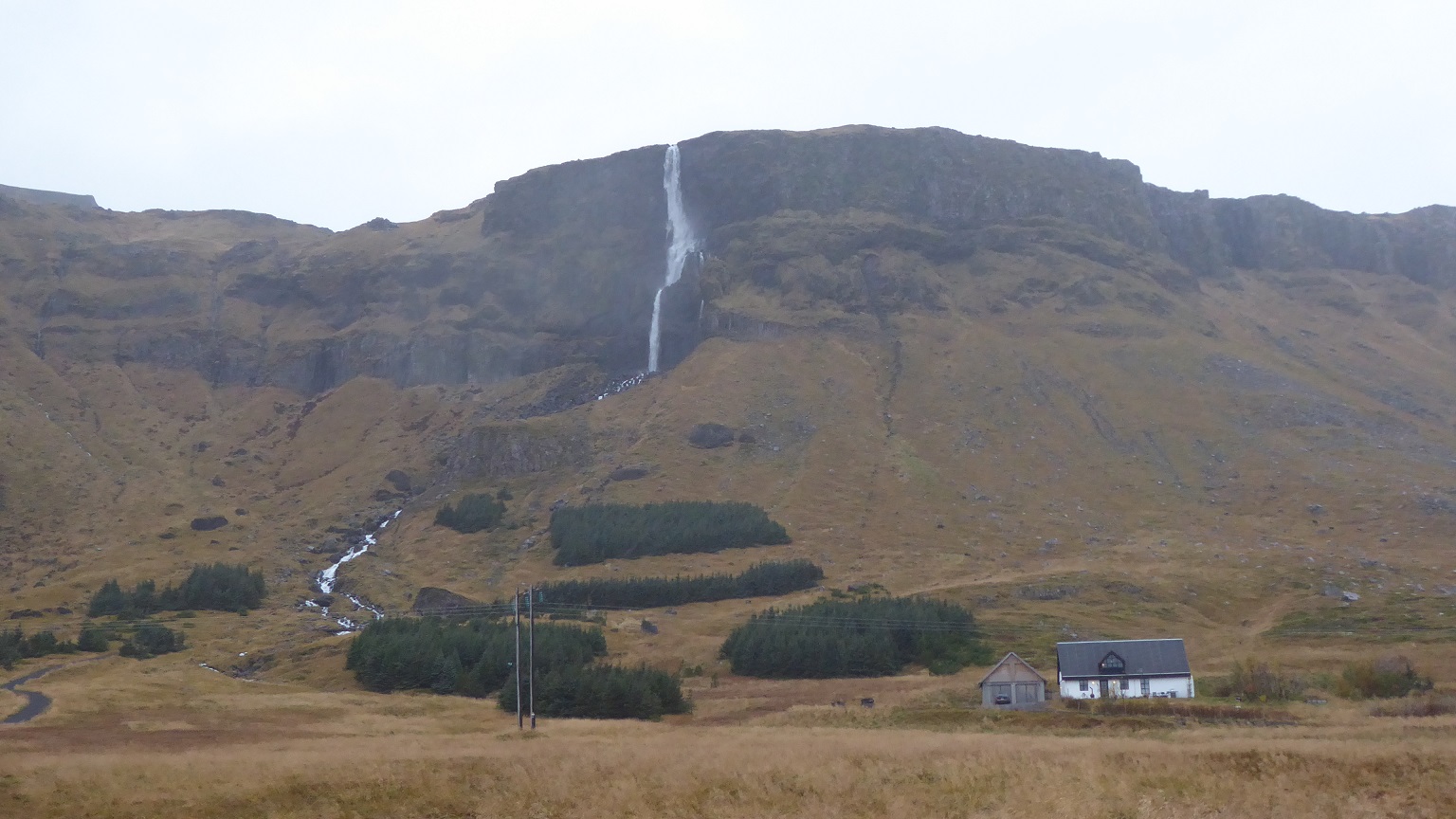
Like to the south, waterfalls were everywhere but fell from even higher
cliffs on this side. This is Bjarnarfoss, whose roar we heard clearly from here. |
 |
The wind was blowing so fiercely that the water off the falls was blown back
up over the edge of the cliff. Marv got a good movie of this phenomenon. |
 |
| The sign welcoming us to Snaefellsjoekull National Park |
 |
| Add caption |
 |
The Lóndrangar are a pair of rock pinnacles in the National Park. They are volcanic plugs
of basalt that have been hewn out from softer surrounding rock by erosion. |
 |
Beyond here, looking back to the east, are the mountains
and the Snaefellsjokull, hidden in the gloom. |
 |
Olafsvik had a coffee shop and a convenience store where we bought
pop and snacks, including soft licorice which is a favorite of all good
Icelanders (and yours truly!). |


No comments:
Post a Comment