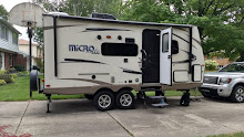


Thu. Oct 28: We awoke today to a breezy and mostly sunny 61°. After a quick bowl of Cheerios and coffee we closed up the camper and drove down to the Peaks of Otter Visitors Center to see their displays. We found out that there was no Wi-Fi at the lodge, and the building isn’t historical, so we didn’t go to visit it at all. Just down the road we took the 1.6 mile hiking trail down to and along the Fallingwaters Cascade. This was a really beautiful and fairly rigorous trail that started out descending steeply to our first glimpse of the water, continued along the side of the cascade for a while, crossed a bridge and headed up the other side of the mountain on a longer but more gradual slope. The vistas were so lovely and the sun filtered through gold, yellow and red leaves. The last part of the trail actually took us above the parking lot level and across Flat Top peak before going back down to the vehicles. We took our time and didn’t push it too much so we were pleasantly tired but not exhausted when we got back. We drove on, enjoying many overlooks and vistas on a splendid day that just got clearer and clearer. About twenty miles after passing the highest point on the Parkway in Virginia (Apple Orchard at 3920 feet), we crossed the James River at the lowest elevation on the Parkway (649 feet). We stopped at the Visitors Center there and bought a National Park Passport that we will try to get stamped from now on, and fill in retroactively for a few spots we have seen since retiring and don’t anticipate getting back to see. Near the Visitor’s Center there is a restored Canal Lock that shows how they tried to fulfill George Washington’s vision of connecting the Atlantic seacoast to the Mississippi River system by way of locks and canals along the Potomac and the James Rivers. The railroad overtook the canals in efficiency before the plan was fulfilled but it was a considerable start on his dream. We enjoyed a picnic on the banks of the James River before climbing back in the vehicles to continue our journey. We continued to stop often to take in the amazing vistas and overlooks and exited the Parkway at the northern terminus about 4:00, driving west about 4 miles to Waynesboro. We found a Kroger and bought some groceries and then went to a McDonald’s for a snack and the Wi-Fi. I quickly updated the blog (without taking time to add pictures), and we each did a short email check and got on the Skyline Drive soon after 5:00. The two drives proved to have many similarities, but the Skyline was a bit busier and, because of an injection of stimulus money, has had a lot of updates recently. There are many more overlooks (75 along its 105 mile length) and things in general are better taken care of. Sunset was fast approaching and we were actually on the western side of the ridge to see that it was going to be very nice. As luck would have it, we came to a turn out just as we needed it. But—ARGH!!—our tax money at work, it was closed. We were relieved that another soon followed and we got some nice pictures there and again after the sun had set completely but the clouds were lit with pinks and purples. We got to Loft Mountain campground after 7:30 and it was quite dark. A herd of 5 deer watched us pull into the campground and then continued their grazing without concern for us. We picked out a large pull through site to share for $7.50 each because of Lou’s Senior Pass. It was right on the edge of the eastern facing ridge, overlooking a valley with twinkling lights far, far below. The Appalachian Trail ran right next to our campsite and in the morning we saw backpackers setting off on their hardy journey. We set-up quickly and decided against cooking our brats on a campfire because the wind was howling outside and the temperature was dropping fast. Instead Lou cooked then in their van and brought them to our camper to eat. We lingered over our simple supper and went to bed about 10:30.

No comments:
Post a Comment