Thursday, February 18, 2010

Day 22--leaving Las Cruces for Tucson--Happy B'day, Chuck & Mom H.!!


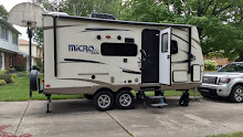
Ahhhh… Tucson! Sunny and mid-seventies predicted for the next 10 days or so. Marv was first in line this morning at Discount Tire in Las Cruces. The bad news was they didn’t have the same tire for us. The good news was they had a like-new passenger car tire that would be okay as a spare, which they mounted and balanced, for free. It would do in a pinch if we needed it. When we get to Phoenix we’ll go to one of the many Discount Tire places they have and get the real thing. Once again, they have won our loyalty. We were back on the road by 9:30. The temperature by then was in the low forties, after below freezing overnight. It was another pretty unremarkable day of driving, but we were interested in the many warning signs about dust storms. All we saw were a few dust devils, luckily. As we approached the border between New Mexico and Arizona we saw more and more mountains with snow on the top. We stopped for a picnic at a rest area about an hour from Tucson where the temperature was still in the low 50s. The rock formations there were fascinating. They looked as if a giant child had scattered handfuls of giant boulders, with some ending up balanced precariously on top of others. It was unlike anything else we have seen before this. We drove on to Tucson and to Gilbert Ray County Campground in the Tucson Mountains, about 3 miles south of Saguaro National Park (West). It’s going to be a great place to spend our time in Tucson. We are camped on the outside of the loop again, surrounded by Sonoran Desert and giant saguaros. Marv took some classic pictures of the sunset, many from our “backyard” at the sight. We have a lot to look forward to here.

Sunday, February 14, 2010

Day 21--Happy Valentine's Day from Las Cruces, NM!


We awoke to a heat wave—instead of being below freezing as it had been for two mornings, it was 38°. We closed up and were on the road by 9:15. The only excitement for the day was when we had an impressive tire blow-out on the camper. It happened on our way to Alpine, on a straight part of the road with plenty of room on the side to change it. We were a bit delayed but on our way again in good order. We couldn’t have made Tucson today anyway so it didn’t matter much. We found out that there was a Discount Tire in Las Cruces, NM so we made that our destination for tonight. We checked in at Sunny Acres RV Park needing its showers and Wi-Fi after three nights without electricity or water. We’re watching our first Olympics coverage and getting back in touch with civilization and heading to Tucson tomorrow. Because we don't have pictures to show for today, I thought I'd just include a few more for Big Bend.

Saturday, February 13, 2010

Day 20--Rio Grande Village in Big Bend


Today we started with two short nature hikes along the southeast road to Rio Grande Village, including one at the visitor center at Panther Junction, before taking a one mile, interpretive hike about the desert at Dugout Wells. By the end of it we could identify Engelmann’s, purple-tinged and blind Prickly Pear cactus. We also found out that lechuguillo is a relative of the century agave, and like its cousin, blooms only one time after 25-30 years and then dies. Unlike its cousin, new plants grow from the roots of old ones, not from seeds. On the east side of the mountains we were seeing much less sotol and more of the “traditional” cactus we were expecting. Leaving Dugout Wells, Marv accelerated to 35 mph, put it in neutral, and we coasted for just over 7 miles! Clearly we were going down to the Rio Grande again. We took a 1.4 mile trail into Boquillas Canyon, which was up a steep hill, down to the river side and along a sand dune. Here the canyon walls are 1500 feet above the river. People by the river are completely dwarfed in photographs taken from the top of the hill. There are Mexican nationals along the bank there with goods for sale on our side. They have cans for one to pay a “donation” for the goods. There were also two men serenading hikers from their side, with cans on our side. They apparently come from the nearby village of Boquillas and ride their horses across the Rio Grande to collect whatever is donated. But there was a reminder in one of our brochures that it is illegal to purchase anything from Mexican nationals. In general, it reminded us of our good fortune to have been born on the north side of the Rio Grande. From the canyon we drove to an overlook for the canyon and then on to Rio Grande Village. There wasn’t much to see there but we ate our picnic at what turned out to be the group camping spot that is right on the river. As we made our way back up the drive we took the spur to Hot Springs. This very interesting gravel road leads to the spot where J.O. Langford made a desert oasis for people to come and “take the waters”. He built a house, a 7 room motor court, a store/post office, a primitive campground and, most importantly, the bathhouse, right on the bank of the Rio Grande. There is an interpretive walk through the area and past ancient petroglyphs and pictographs which show that people have “taken the waters” for thousands of years. All that remains of the bathhouse is the foundation, because anytime the Rio Grande goes over three feet, the area would flood. But lots of people still go there to soak in the waters. There seemed to be a men’s retreat or something going on there, with about 16 guys who all knew each other. We satisfied ourselves with just soaking our feet before heading back to the truck. By then it was 73°, the highest temperature we’ve seen on the trip. We returned to the campsite where surprisingly it was in the low 60s and the camper was warmed by the sun. After cleaning up a little bit we hiked a half mile up the mountainside to the lodge to enjoy a dinner out and ended the evening, once again, with a Northern Exposure. We feel like we have done a pretty good job of Big Bend in three nights here but will leave with some things to do should we ever return.

Day 19--Ross Maxwell scenic drive in Big Bend


We managed to dress in the 34° camper, eat breakfast, and make a lunch, and still make the 8:30 ranger hike entitled “There’s a bear (or a mountain lion) in my sandbox!” The ranger led us on an informative hike of the 1.8 mile Chisos Basin trail illustrating what makes the area ideal habitat for both bears and mountain lions. Despite his careful searching, we didn’t see any of the hoped for signs (scat or tracks) of either one. Since there are only about 2 dozen of each in the park and most of the bears are hibernating while their food sources are low, it wasn’t that surprising that we didn’t see them. It was still an interesting hike with fantastic views, the first of many for today. I bought a sotol walking stick from the Gift Shop at the lodge with my Christmas gift card from Mom, a decision for which I was grateful all the rest of our time at Big Bend. Leaving the basin, we took the Ross Maxwell scenic drive south and west all the way to where it ends at Santa Elena Canyon. After eating our picnic lunch we set off on the 1.9 trail into the canyon. We had to cross Terlingua creek, which was very shallow and hardly running today. Then we headed up a switch back trail that climbed along the U.S. side of the canyon. At the end of the trail we scrambled down and over huge boulders that had fallen from the canyon sides. There is a small beach there on the very narrow Rio Grande. Across from us and beyond this point the canyon walls rise 1050 feet straight up! As we made our return trip on the Maxwell drive we hoped to stop at each of the many interpretive plaques and walks along the way. By now the temperature was up to 71°. We drove through the Cottonwoods Campground on the Rio Grande, stopped by the Castolon ghost town, and did some short trails to see Mule Ear peaks, Sotol Vista Overlook, Tuff Canyon and several other stops. When we got to Burro Mesa Pour-off we decided to take the 1 mile trail to see the dry waterfall in the box canyon. This easy trail ended with the spectacular towering scoured wall that attested to the large amount of water that must cascade through after summer thunderstorms. By then we were feeling pretty conversant about the Chihuahuan desert including plants such as sotol, ocotillo, Century Agave, and lechuguillo; volcanic terms like tuff, dikes and silicate rich lava; and the habitats of bear and mountain lions. After a quick dinner in the camper we walked to a ranger program at the amphitheater on “The Four Seasons at Big Bend”. We marveled at the incredible stars on our walk back and finished our evening with a Northern Exposure on the computer. It was a very good day.

Day 18--Chisos Basin Campground in Big Bend National Park


OK, words are beginning to fail me now that we are in Big Bend National Park. Amazing, awesome, magnificent; none of them are adequate. We are camping in the Chisos Mountains Basin at 5,300 feet, under the looming Casa Grande, a 7,325 foot volcanic peak. After paying (gulp) $3.06 for gas this morning we headed south from Marathon into the park. The campground is not recommended for trailers longer than 20 feet (which is what we are) because of steep grades and tight curves. But we got in without a problem and had a large choice of campsites. As expected there is no electricity, but there are flush toilets and cold running water in the rest rooms. We set up under the watchful gaze of 6 deer lounging two campsites away from us. The campground host assured us that food in a hard sided camper like ours would be safe from the bears and javelinas that are also visitors. We decided to take the 5 mile Window Trail, which begins at the campground. The first .25 mile was down steps which were put in by CCC workers. We could only imagine what coming back was going to be like! The rest of the trail was a more gradual descent of about 800 feet passing through an interesting mix of desert and mountain flora. The final .25 was a scramble over slippery rocks, lightly running creek bed and impressive rock steps. We clearly couldn’t have gotten in there without the steps. And then we were at the top of the Window pour-off, where the water drops 200 feet to the desert floor. Through the fissure canyon created one can see for miles across the desert to other mountains in the distance. The so called “Window” is a stunning view. As we got our pictures it began to drizzle and sleet a bit so we began the trip out. And what a climb it was! But the magnificent scenery all around made it worth it. After we recovered a bit at the camper we drove up to the lodge, which is about a mile up the hillside. We found out they have Wi-Fi and a restaurant up there, so we plan on celebrating an early Valentine’s Day on Saturday night with a meal out. We took the very easy .3 mile Window Sunset Trail for views of the sunset, which was becoming more interesting as the clouds began to clear. Later in the year the sun must go down right through the gap, but this time of year the spectacular vision is the color of the pinnacles surrounding us as the sun turned them bright red. Back at the camper we made dinner and ran the heater enough to keep it about 50° inside, as the temperatures slid down into the thirties.

Thursday, February 11, 2010

Day 17--Seminole Canyon Pictographs


Hurray!! Although we heard a bit of precipitation before sunrise, it was cold (41°) and windy but dry when we got up and took down the camper. We made it easily in time for the 10:00 hike to see the pictographs. Our guide took a group of 19 down into the canyon and along the mostly dry, rock, river bed to Fate Bell Annex, which is almost directly below the Visitor Center. We learned there are 3000-4000 year old pictographs throughout a 50 mile radius which are done in what is called the Pecos River style. Most are on private lands but these are some of the easiest to access. They are also very well documented because a couple in the 1930s trekked into the area and made painstaking copies of them. The park does less frequent hikes to the Panther Cave and to the cave we could see to our left, where the canyon takes a turn. But these are magnificent and were what we had stayed to see. They are in good shape, considering their age, partly because no sunlight shines on them, but the Amistad Reservoir to the east of here has raised the humidity in the area, which is taking a toll. As we had noticed in the area before, there is a lot of pock-marked limestone, very much like what we found on Drummond Island. It is full of fossilized sea shells and creatures, and that in itself is interesting to see. But the mysterious pictographs drew us into their spell. No tribes in the area claim their makers as ancestors and so there is no oral history to explain them. Careful analysis shows that some that were drawn 4000 years ago were painted over 3000 years ago, but no one knows why. Everyone from archaeologists to school children enjoy making up their own stories and interpretations but they remain, as they have always been, a mystery to enjoy. After our hike we drove west on Highway 90 to Marathon. We decided to stay at the motel/RV park there so we could do laundry and use their Wi-Fi to update the blog and check email for a night before heading to non-electrical camping in Big Bend National Park. We were surprised to find many of the people we had just hiked into the canyon with, all with the same plan. However, the Wi-Fi was down and they couldn’t say if it would be fixed before we leave tomorrow. L We borrowed a cable and hooked into their cable TV and learned of the latest blizzard to hit the east coast. As everyone we have talked to, from Pennsylvania, Quebec, Nova Scotia, Wisconsin, etc. agrees, it may be unusually cool here but at least we don’t have to shovel this!

Day 16--Rio Grande Trail at Seminole Canyon


The temperature got down to 34° last night but we stayed cozy. After oatmeal we went to the visitor center and looked at the display of the history of the region from prehistoric hunter-gatherers through the railroad builders to the sheep and goat ranchers of today. It was sunnier and warmer than predicted so we decided to pack a lunch and ride our bikes on the Rio Grande Trail. It turned out to be a highlight of trip. We first took the left hand trail to an overlook of Seminole Canyon of the Pecos River. It was magnificent and we spent a long time scrambling over the rocks at the canyon’s edge. From there we continued on the main trail to the overlook of the confluence of the Pecos River and the Rio Grande. At that point we were about 160 feet over the river with spectacular views up the Pecos and up and down the Rio Grande. We also could see into Panther Cave across the Pecos which has some of the most remarkable pictographs in North America. We couldn’t see them with our bare eyes and we had forgotten the binocularsL. But Marv got a great picture which does show them. We had shared the path with two other couples on bikes and two couples hiking, but there was no sign of them now. We had our picnic overlooking the two rivers, with no sign of civilization. We walked along the edge of the area and got more pictures before climbing on our bikes for the trip back. We rode about 7 miles in all, most of it a mixture of rock surface and dry mud, but some of it broken pieces of rock that was pretty rugged. Back at camp we spent some time sitting in the sun and reading, enjoying 62° temperatures until high clouds came in and dropped the temperature quickly. We finished the trout fillets and had red beans and rice for dinner.